# 8% of Mexico Hosts Over...

## Metadata
- Author: [[@tomaspueyo on Twitter]]
- Full Title: 8% of Mexico Hosts Over...
- Category: #tweets
- URL: https://twitter.com/tomaspueyo/status/1809234336501141943
## Highlights
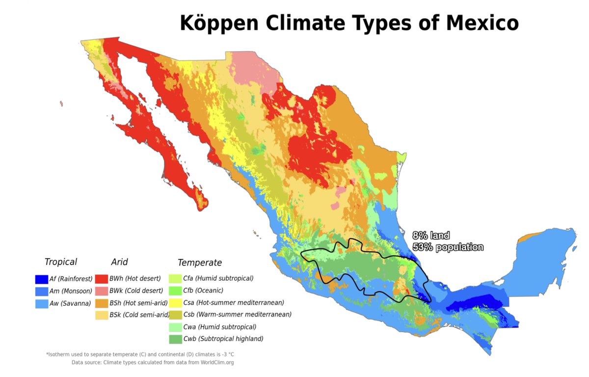
- 8% of Mexico hosts over 50% of its population
Why?
Understanding it also explains the Aztecs & their pyramids
🧵 <video controls><source src="https://video.twimg.com/tweet_video/GRuvUSIXEAEL55G.mp4" type="video/mp4">Your browser does not support the video tag.</video> ([View Tweet](https://twitter.com/tomaspueyo/status/1809234336501141943))
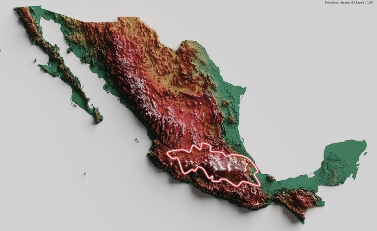
- This map shows crisply this area of high population density. Why there?
(cc [researchremora](https://twitter.com/researchremora))
 ([View Tweet](https://twitter.com/tomaspueyo/status/1809234340028518412))
- And it's not a very flat area. It's some of the most mountainous land in all of Mexico!
 ([View Tweet](https://twitter.com/tomaspueyo/status/1809234344831057992))
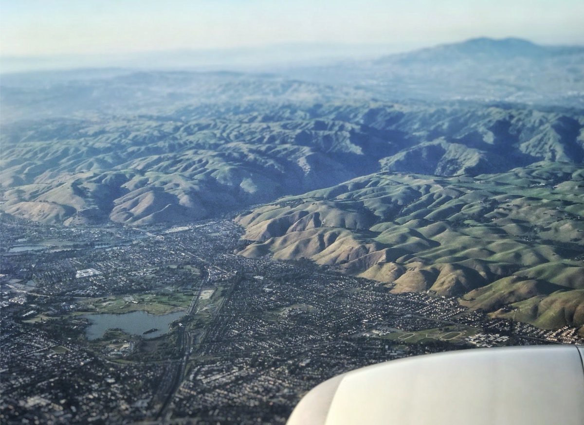
- Usually, most population lives on plains, like on these pics from the SF Bay Area and of the suburbs of Lima
Why such a huge population on a highly mountainous area?
 ([View Tweet](https://twitter.com/tomaspueyo/status/1809234348685529455))
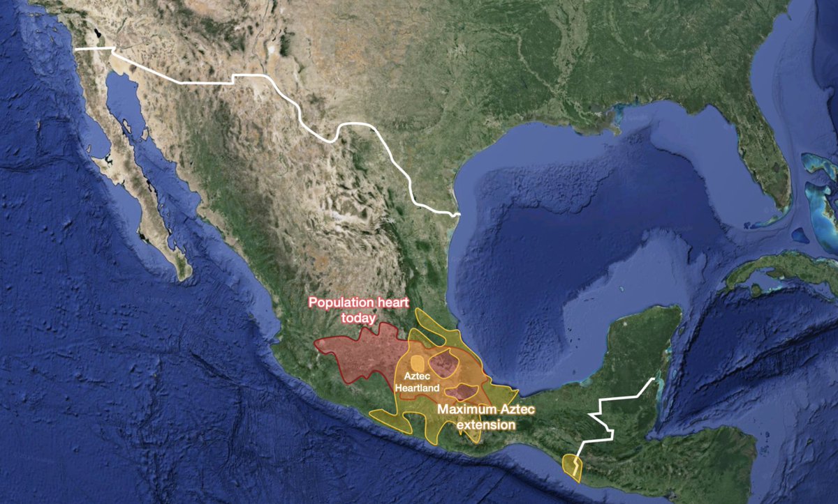
- It's not a recent phenomenon
It is also where the Aztec Empire used to be
 ([View Tweet](https://twitter.com/tomaspueyo/status/1809234353219670023))
- It's even more surprising because it's smack in the middle of the Horse Latitudes, areas that tend to be very desertic
 ([View Tweet](https://twitter.com/tomaspueyo/status/1809234357460009263))
- Luckily, because this area is elevated, mountains catch the humidity carried by winds from the oceans. It rains here, but not massive amounts
(precipitation map vs satellite map) <video controls><source src="https://video.twimg.com/tweet_video/GRum5AKa4AA-Ju7.mp4" type="video/mp4">Your browser does not support the video tag.</video> ([View Tweet](https://twitter.com/tomaspueyo/status/1809234361922772994))
- Of course, high altitudes also mean lower temperatures, despite being in a tropical area
 ([View Tweet](https://twitter.com/tomaspueyo/status/1809234366091931992))
- The result is that Mexico City has pretty stable and mild temperatures throughout the year
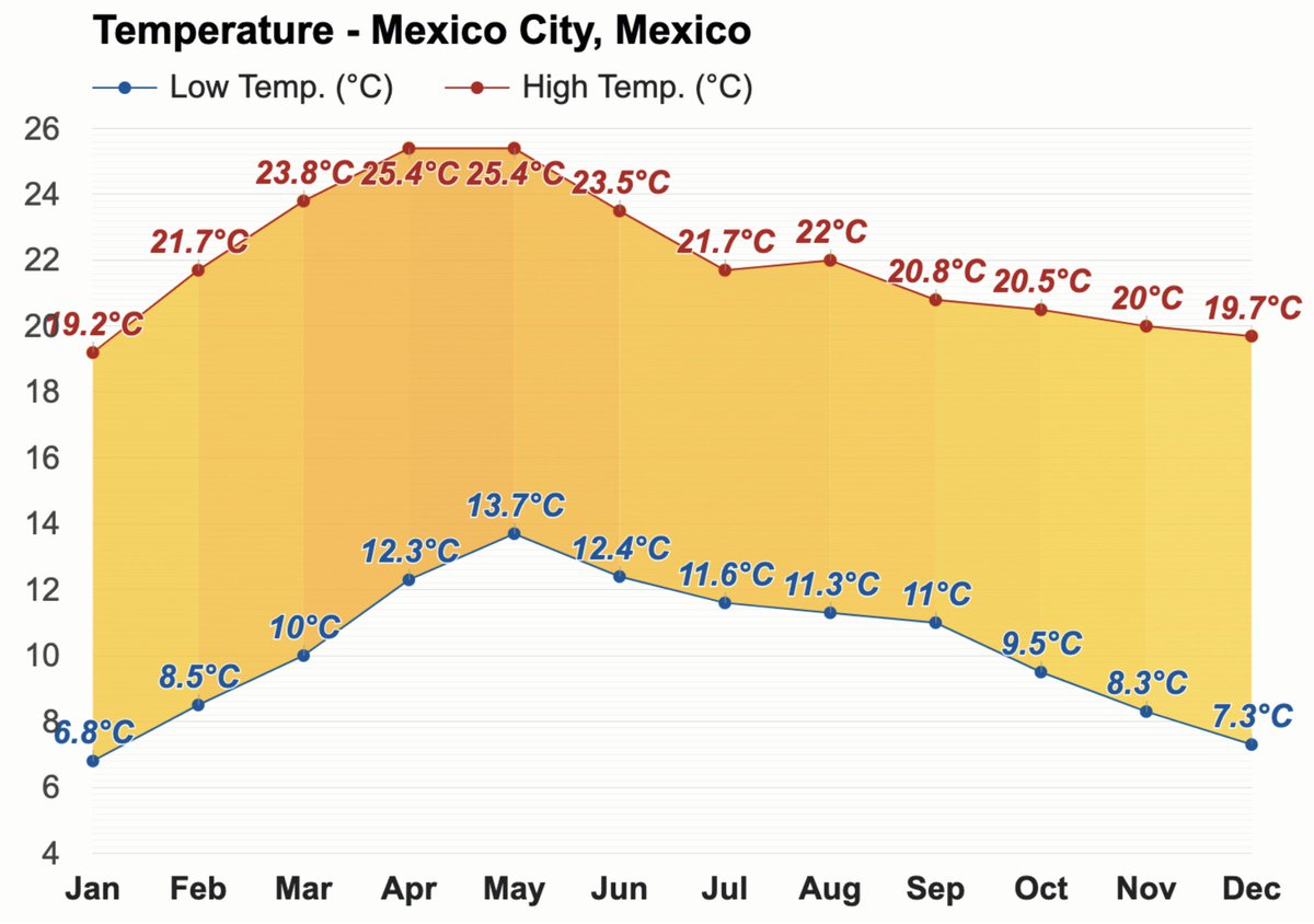 ([View Tweet](https://twitter.com/tomaspueyo/status/1809234369778753587))
- If you combine rains, altitude, and latitude, you end up with a very good climate
But that's not all!
 ([View Tweet](https://twitter.com/tomaspueyo/status/1809234374207938913))
- This is a map of river basins in Mexico
Usually, rivers flow to the sea.
But sometimes, in mountainous areas, it gets trapped. It can't escape, and forms lakes.
See the 4 small areas at the bottom?
These "endorheic basins" used to form 4 huge lakes
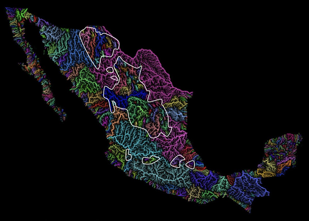 ([View Tweet](https://twitter.com/tomaspueyo/status/1809234378574197142))
- Here's the 3rd one from the left. You probably recognize it:
 ([View Tweet](https://twitter.com/tomaspueyo/status/1809234382546260459))
- It used to be Lake Texcoco, which hosted Tenochtitlan, the home of the Aztecs
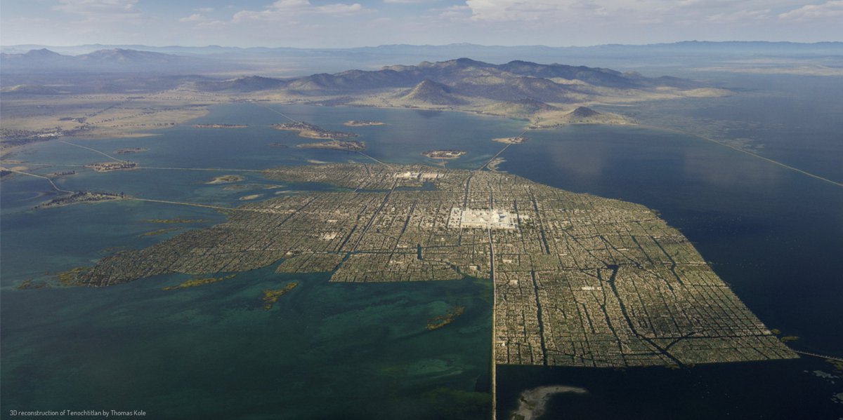 ([View Tweet](https://twitter.com/tomaspueyo/status/1809234386430140529))
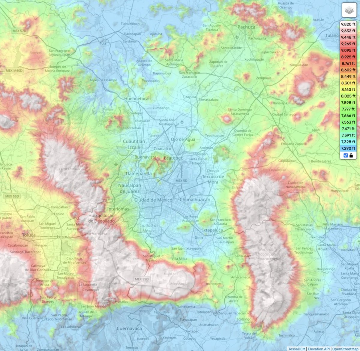
- If you look at the topography around it, you can see how all these mountains trapped the water into this inner lake
 ([View Tweet](https://twitter.com/tomaspueyo/status/1809234390603722891))
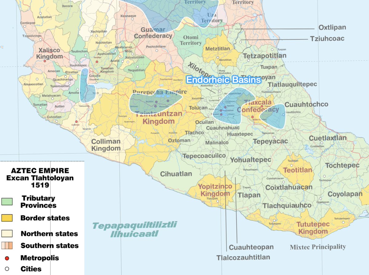
- Comparing these 4 lakes helps understand the politics of Mexico before the Spanish:
• The homeland of the Aztecs was in one lake
• The other lakes were also very fertile, which made the locals Tlaxcala and Tzintzuntzan powerful. The Aztecs couldn't conquer them
 ([View Tweet](https://twitter.com/tomaspueyo/status/1809234394843898058))
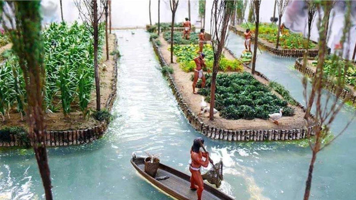
- The Aztecs built Chinampas on the lake by piling up mud on the lake (which was quite shallow) and fencing it with reeds
The mud was very fertile, and the plots were irrigated by the surrounding water
That's allowed the Aztecs to produce lots of food➡️ppl
 ([View Tweet](https://twitter.com/tomaspueyo/status/1809234399830888569))
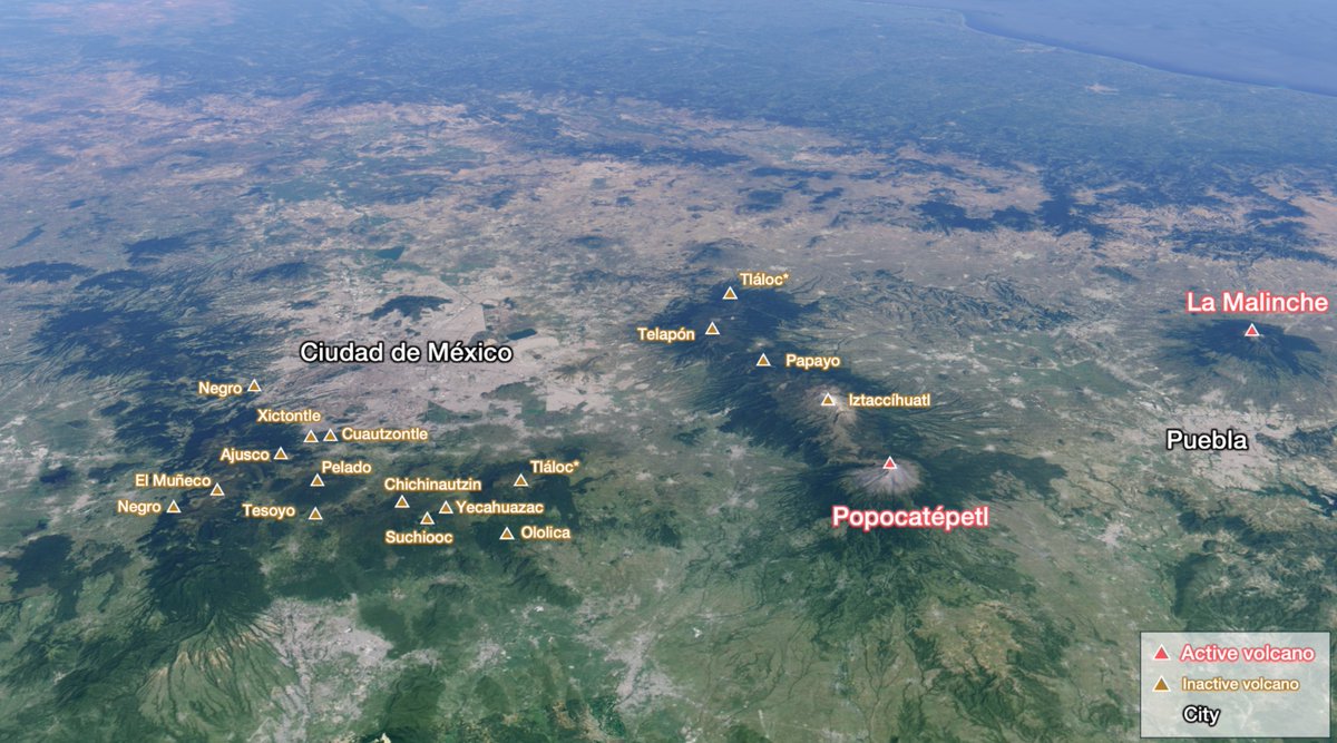
- But why is Mexico surrounded by mountains in the first place?
These are not simple mountains. These are volcanoes
I placed the ones I could easily find here
They're everywhere!
 ([View Tweet](https://twitter.com/tomaspueyo/status/1809234404180472173))
- In fact, this is true for the entire area: It's a volcanic belt!
("Trans-Mexican Volcanic Belt"), with many active volcanoes
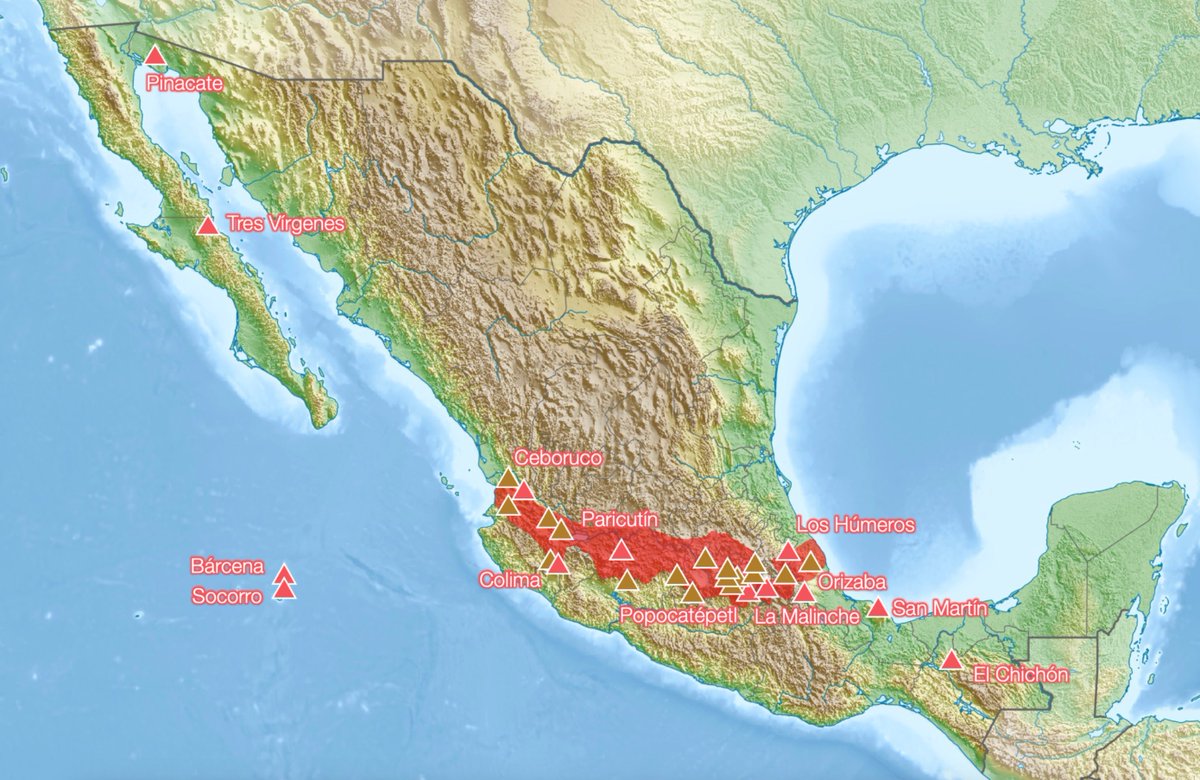 ([View Tweet](https://twitter.com/tomaspueyo/status/1809234409255522670))
- Why? Because the Cocos Plate hits the North American Plate and subducts under it
The friction creates heat, which melts rock and converts it to lava, which goes up and escapes the crust through volcanoes

 ([View Tweet](https://twitter.com/tomaspueyo/status/1809234413781213188))
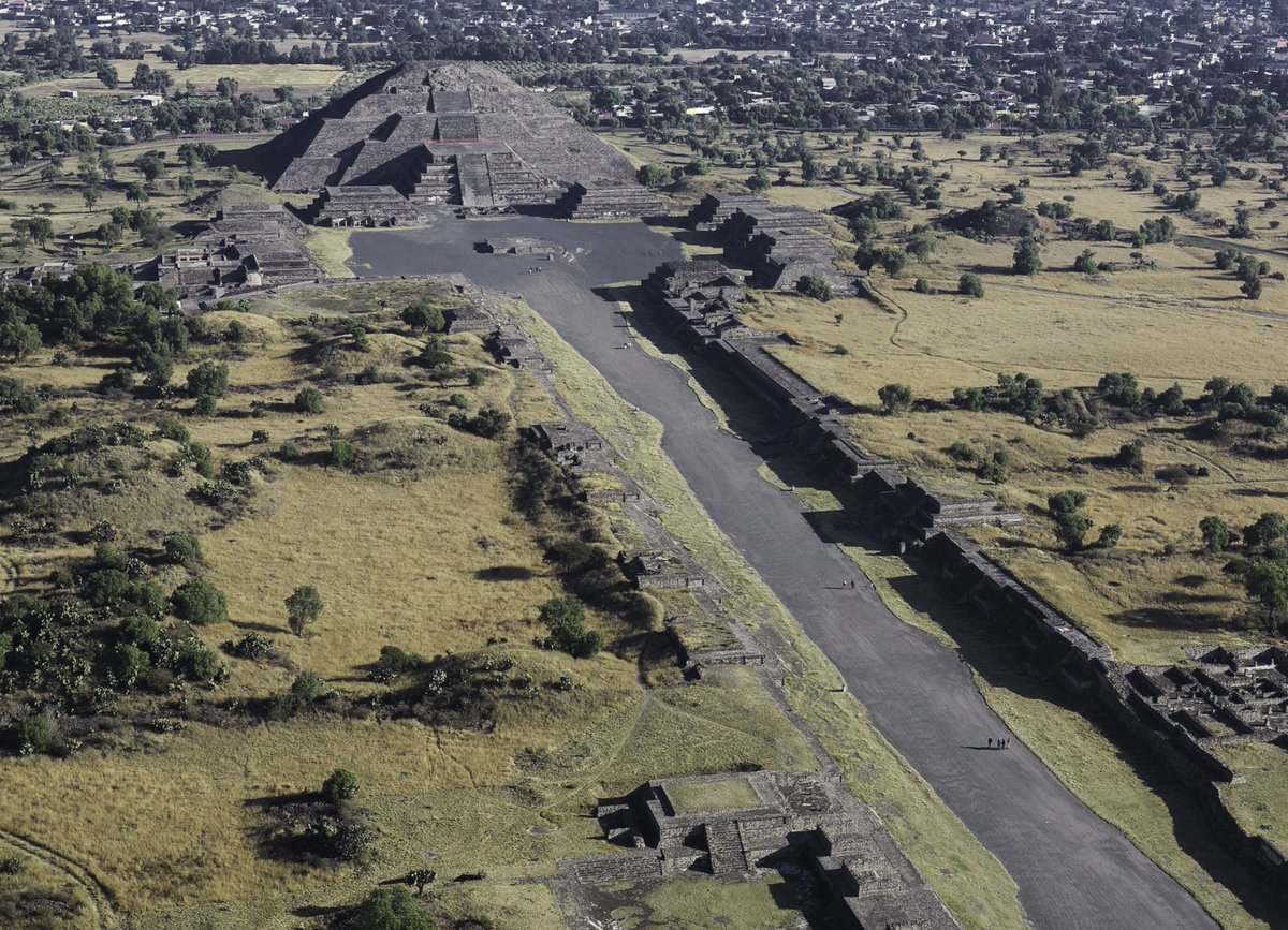
- No wonder why indigenous peoples, surrounded by volcanoes (some of which destroyed their cities), would build similar-looking pyramids for their religion
Some gods, like the god of rain Tláloc, were supposed to live in mountain and volcano peaks
Think about that
 ([View Tweet](https://twitter.com/tomaspueyo/status/1809234417824506254))
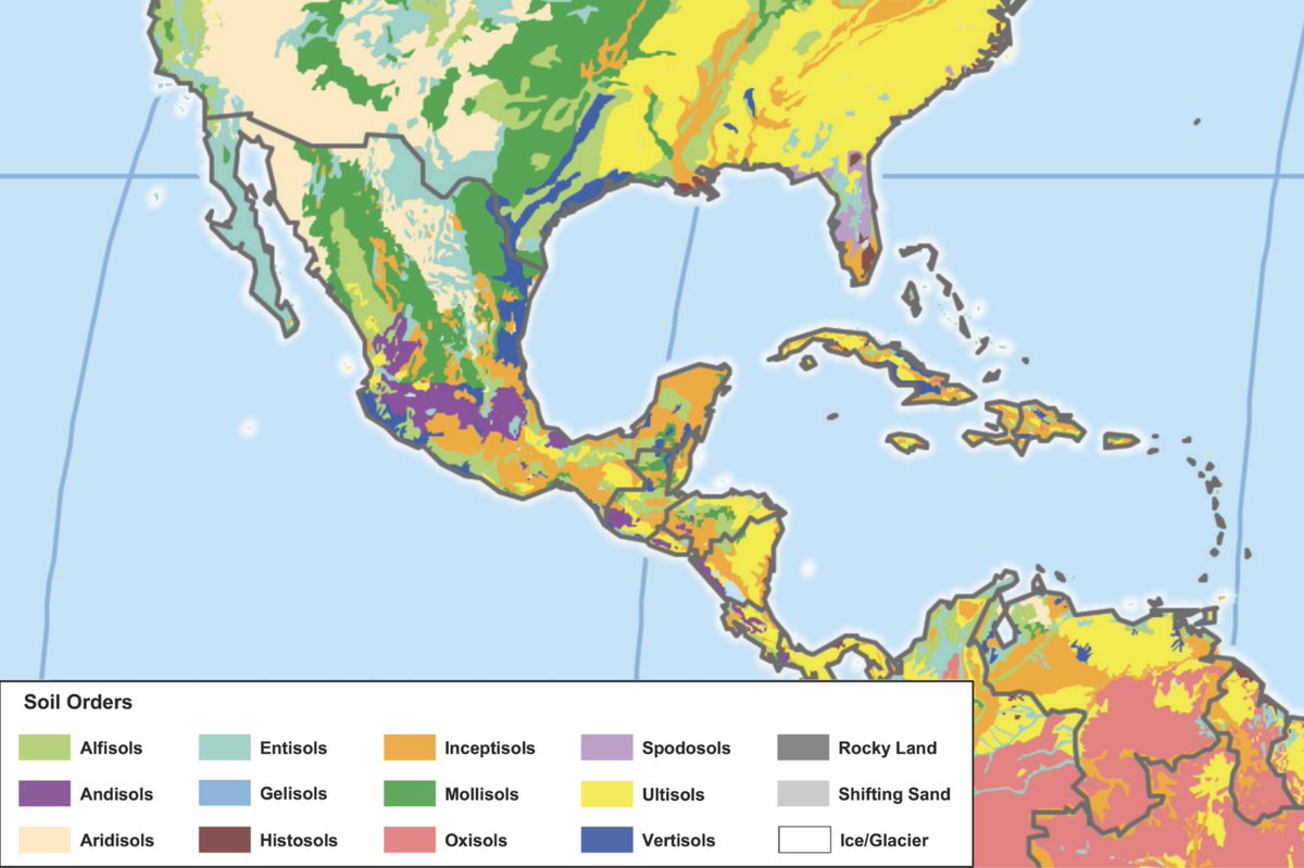
- The eruption of all these volcanoes for millions of years produced one of the most fertile soils in the world. You can see it in purple here ("andisols")
 ([View Tweet](https://twitter.com/tomaspueyo/status/1809234422559904169))
- If you compare the current population heartland with the area with good climate, the trans-Mexican volcanic belt, and the region with good soil, this is what you get:
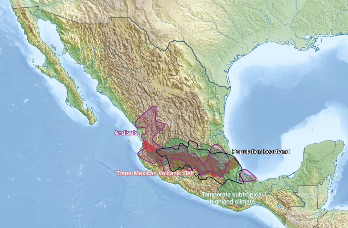 ([View Tweet](https://twitter.com/tomaspueyo/status/1809234427391725679))
- So this is why the Mexican pop concentrates here:
1. Tectonics➡️elevate the region+volcanoes
2. Volcanoes➡️fertile soils
3. Altitude➡️good climate + catch rain
4. Rain+volcanoes➡️rivers & lakes
5. Rivers➡️sediments➡️fertility+flatlands ([View Tweet](https://twitter.com/tomaspueyo/status/1809234430562627914))
- Lakes+rains+rivers+climate+flatlands+fertile soils➡️Huge agricultural productivity
The Aztecs could get up to 7 harvests/year!
No wonder Tenochtitlan was one of the top 5 most populated cities in the world around 1500, with 200-400k ppl!
And why the Aztecs were so powerful ([View Tweet](https://twitter.com/tomaspueyo/status/1809234432521273357))
- So this is why the Mexican heartland is here
Next up: Why, despite this, Mexico has been poorer than the US, and where we can expect its economy to go from here
Follow me to get that thread!
Or better yet, subscribe to the free newsletter to not miss it
https://t.co/HQAb8iSwpt ([View Tweet](https://twitter.com/tomaspueyo/status/1809234434400350697))
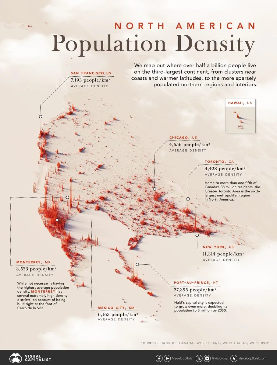
- I just found this other map that shows how massive the Mexican heartland is: It's 35% more populated than the US northeastern megapolis that runs from Boston to DC!
 ([View Tweet](https://twitter.com/tomaspueyo/status/1809364682337132931))